Part of the fun of this trip is waking up and not being entirely sure what cardinal direction you are going to take that day. That was the case this morning. It is now Monday, and my car has to be in Wednesday morning. I've exhausted the main things I would like to do in the Taupo and Rotorua area. Probably shouldn't go south anymore, just more to drive tomorrow.
Spent some time reading and decided that a nice, comfortable beach would be nice. The Coromandel region is an area I am not planning to visit by bike, and it's in the general direction of Auckland, so it seemed a good choice. It'll be about a 3-hour drive at least, depending, of course, on road windiness.
I head to the local internet place and do some Skyping. No word yet on the warranty request, maybe tomorrow.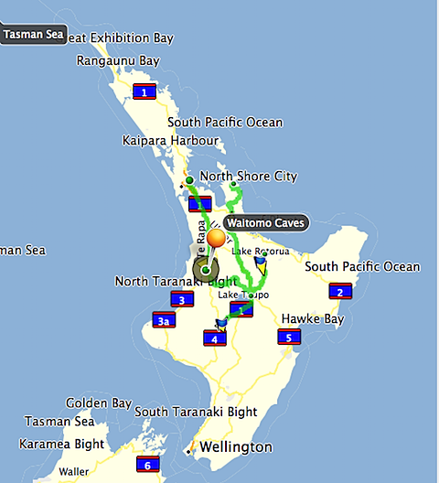 General map of where I've been in the car so far - Waitomo Caves, Taupo, Rotorua, Tongariro Natl Park. The green line heading up on the right side is today's drive. The little peninsula that it is sitting on is the Coromandel Peninsula. The little dot at the end of that is Whitianga, my goal today.
The drive is easy, scenery particularly nice as it continues to be sunny.
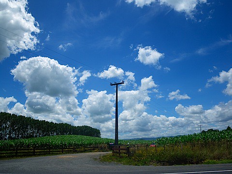 There were acres of land without telephone poles, but I managed to get one!
I ended up coming through Matamata. To those uninformed, this is also known as. . .
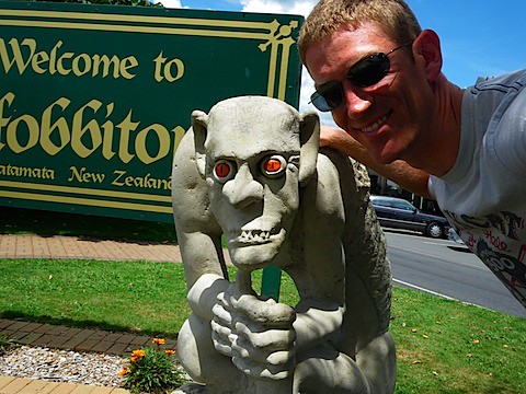 This guy reminded me of a patient of mine. This picture is precioussssss.
Yes, Hobbiton from the Lord of the Rings. The cars in the background would suggest that life has become easier for the little folk.
 Area around Hobbiton.
I had actually come through Matamata about four years ago. Though they continue to hold trips to the place where the movie was filmed, the town itself has decreased the "hobbit-esque" theme somewhat in the intervening time. I am sure that this will change once the next major movie is filmed.
As I came closer to the Coromandel Peninsula, it became much more steep, further cementing my plan NOT to bicycle this area.
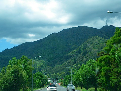 One of the small towns in the Coromandel region. The road eventually cuts across the mountains ahead. Very nice when you are burning gas rather than calories.
The road soon wound around the very craggy coast, often from higher elevations.
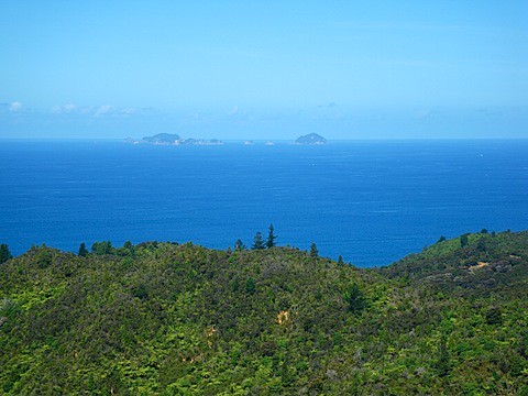 Looking out over the eastern coast of the Coromandel peninsula. I have no idea what the name of those islands are, therefore, from now on, they will be named Armstrong Island and Cox Island. You heard it here first.
Eventually, pulled into Whitianga. Pretty little town right on the beach, with a nice harbor. I set up the tent - by that time, it was about 5PM. Decided on a run to settle the soreness from the hike yesterday.
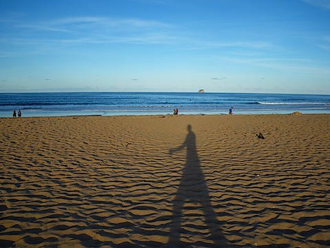
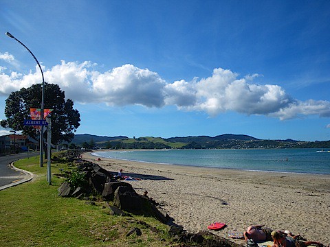 The town is to the left of the picture. Few people out on the beach despite the perfect weather.
Ended up a ways back in the harbor.
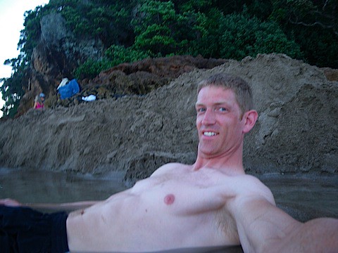
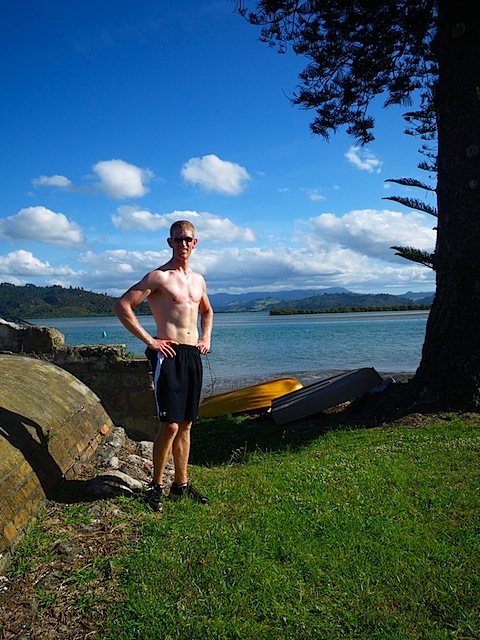 Looking south toward the little inlets. Advantage of this picture is that I could test the white balance right off my chest.
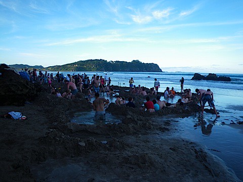
While running, stopped in at an information center and found out the best times to check out the close-by Hot Water Beach. It is a pretty amazing spot where a hot springs bubbles out right under the beach. All you have to do to have your own, personal spa is to dig down to it and let the hole in the sand fill up. It only works at low tide, though, which is 7PM through 10PM tonight. Perfect way to relax after a run, I think.
Made a quick dinner, then off to Hot Water Beach - it's about 20 miles.
 This is the Cold Water Beach next door to the Hot Water Beach.
As I came closer, I realized that I may not be the first person that discovered this particular area.
 Apparently, there is no warm water in the rest of the country. Dang.
I quickly learned a few things about this area. First, and most importantly, there are no warnings about the heat of the water, which (defying physics) may have actually been well above the boiling point in some areas. Amazingly, just two feet away from there, it may be perfectly comfortable or even cool. Setting up my pool was an exercise in controlling the warm flows and cool flows.
 Ahhhh. Perfection.
Occasionally, a particularly large wave would come along and roll over the primitive walls set up around the pools. Luckily, kids with shovels build them back up. It seemed to be quite a game, and it helped to refer to them as the "castle walls".
It's a fun group of people here, talked with a number of people including an actuary from Trinidad who now lives in Canada. Cool guy, has done a lot of traveling, recommended Jordan as a place to go. Also mentions that Trinidad has one of the highest murder rates per capita in the world. I think I will probably NOT go there for the time being. We chat for probably an hour while lounging in the pool.
 Child labor laws are lax on this beach. Excellent.
Also meet some people from Britain (they seem to be the biggest travelers to New Zealand) and talk with them until, finally, two giant waves crash over the whole scene and destroy the walls to the point that even child labor cannot repair them.
It's dark by that time, so back I go.
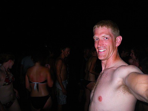 Just after the tsunami waves destroyed the pools for good.
A VERY cold shower at the top of the beach gets most of the sand off, but a hot shower back at camp really feels good. I end up talking to the people in the campsite next to me for quite a while, as they are offering beers. They are three younger guys from the south part of the north island, and I had helped them repair their broken tent pole. By the time I climb into the sleeping bag, it is midnight and I drop off immediately. Tomorrow, probably will head back to Auckland and set up a place to put my stuff while the bike gets finished up. Let's hope it is that easy.
Cox Island is the bigger of the two
ReplyDeletesweet, we have an island!
ReplyDeleteTheresa